A Clipper Brings Additional Quick Snow to the Northeast

The Northeast has gotten another few inches of snowfall on top of the historic blizzard that swept through the region earlier this week. The active winter pattern continues to target the Northeast after recent storms left behind widespread snow totals and towering snowbanks.
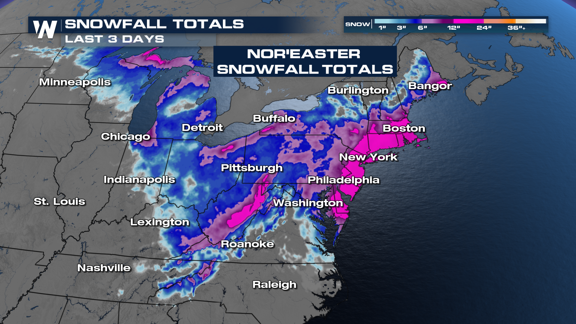
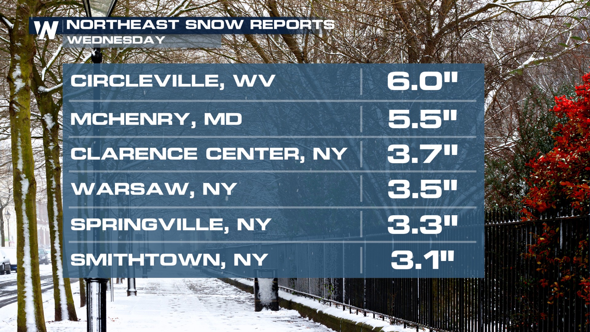
By no means the snow that fell on Wednesday rivaled the intensity of the Blizzard of 2026. However, there were snowfall totals of six inches in Circleville, WV.
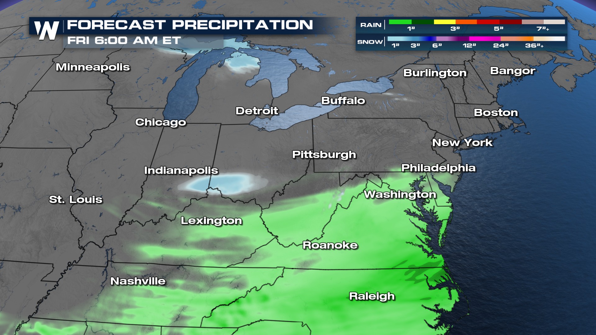
Light to moderate snowfall will move out of Indiana and Ohio Thursday morning. Another little batch of snow could move back to the I-95 corridor as we head into your late Thursday. Mostly rain is going to plague the Mid-Atlantic and Mis-South through Thursday, as this system moves off the coast later in the day.
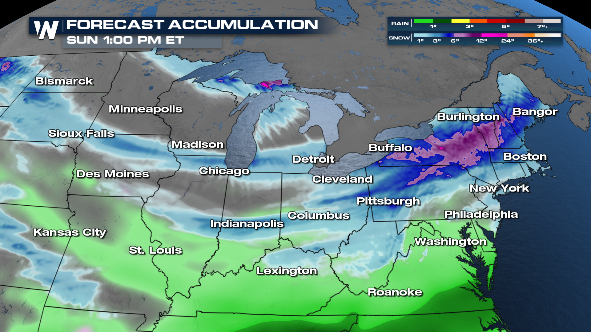
This amount of snow will be lacking compared to our Nor'Easter, but an inch or two is still possible and still needs to be taken with caution.
 Another clipper is likely to dive in from the northern Plains through the Great Lakes and Ohio Valley and back into the northeast by Friday and Saturday.
Temperatures are expected to remain cold enough to support snow rather than rain in many areas, particularly north of major metropolitan corridors. That means the wintry feel will stick around, and melting will be limited until a more sustained warm-up arrives. Residents are encouraged to allow extra time for travel and use caution on untreated roads as the Northeast continues to navigate a persistently snowy stretch of winter weather.
 Stay tuned to WeatherNation for more details.


